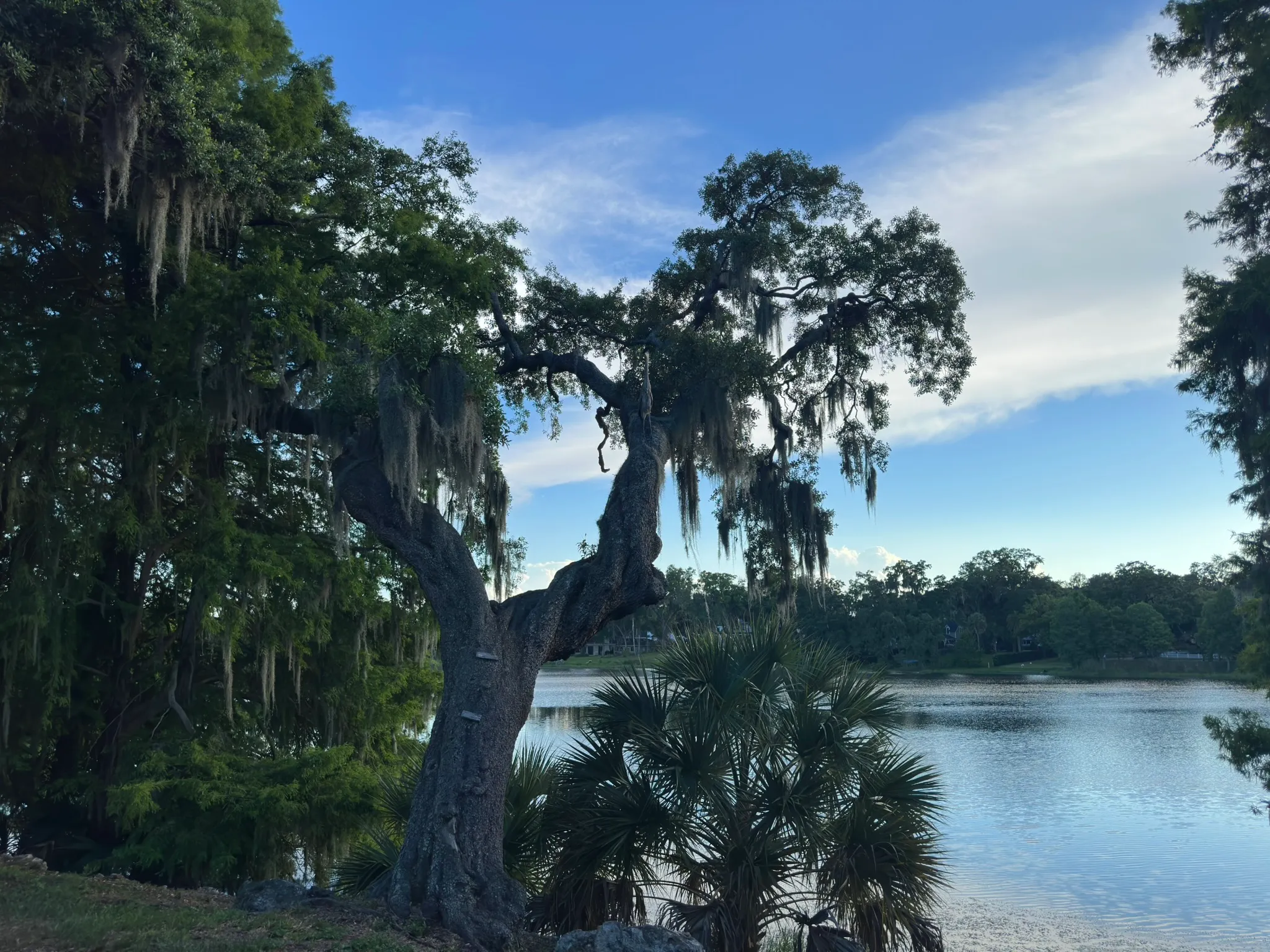
Twelve acres of shallow water on the southern edge of downtown Orlando. Brick streets around it. Live oaks heavy with Spanish moss along the shore. The City has tracked the water quality for close to forty years. The neighborhood is named for the lake, and what follows is what’s true about it.
About the lake
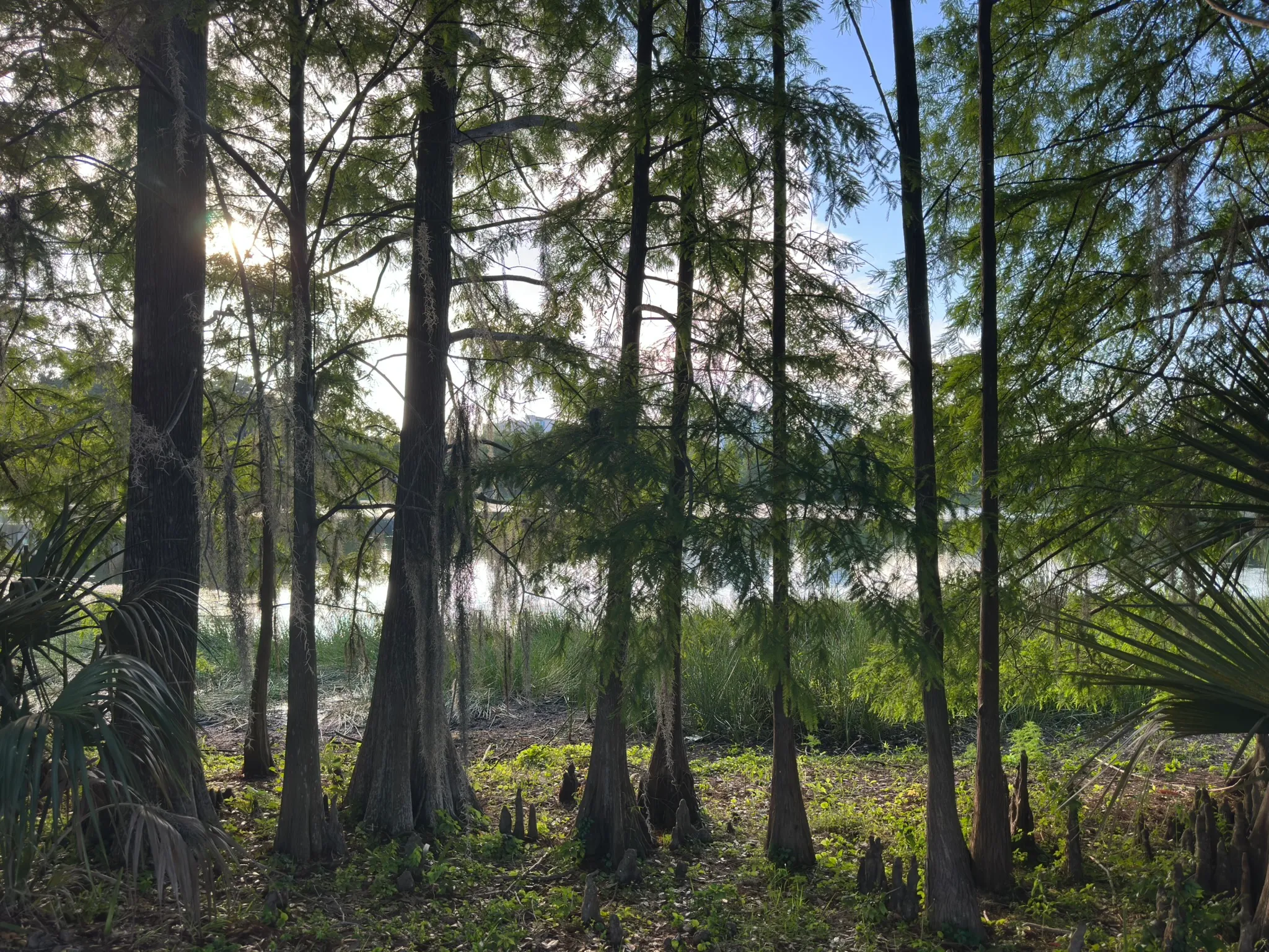
Lake Cherokee covers twelve acres and isn’t deep. Its formal hydrologic identifier is WBID 3168X6, at 28.533° N, 81.371° W. The City has tracked its water quality continuously since September 1987, close to forty years of records across fifty-five parameters and the longest dataset that exists about the lake.
The lake sits in the Little Econ Watershed, part of the Middle St. Johns River Basin. By that classification it drains, eventually, into the St. Johns. Whether it has continuous surface outflow or only releases at high water is detail the City’s stormwater maps would settle.
This page isn’t the place for the lake’s recent water-quality story. 2025 was Lake Cherokee’s worst year on record: highest chlorophyll-a and total phosphorus of the forty-year dataset, a documented fish kill, confirmed cyanotoxin-producing cyanobacteria. The full assessment and the case for restoration are on the Lake Restoration page.
The canopy — live oaks and Spanish moss
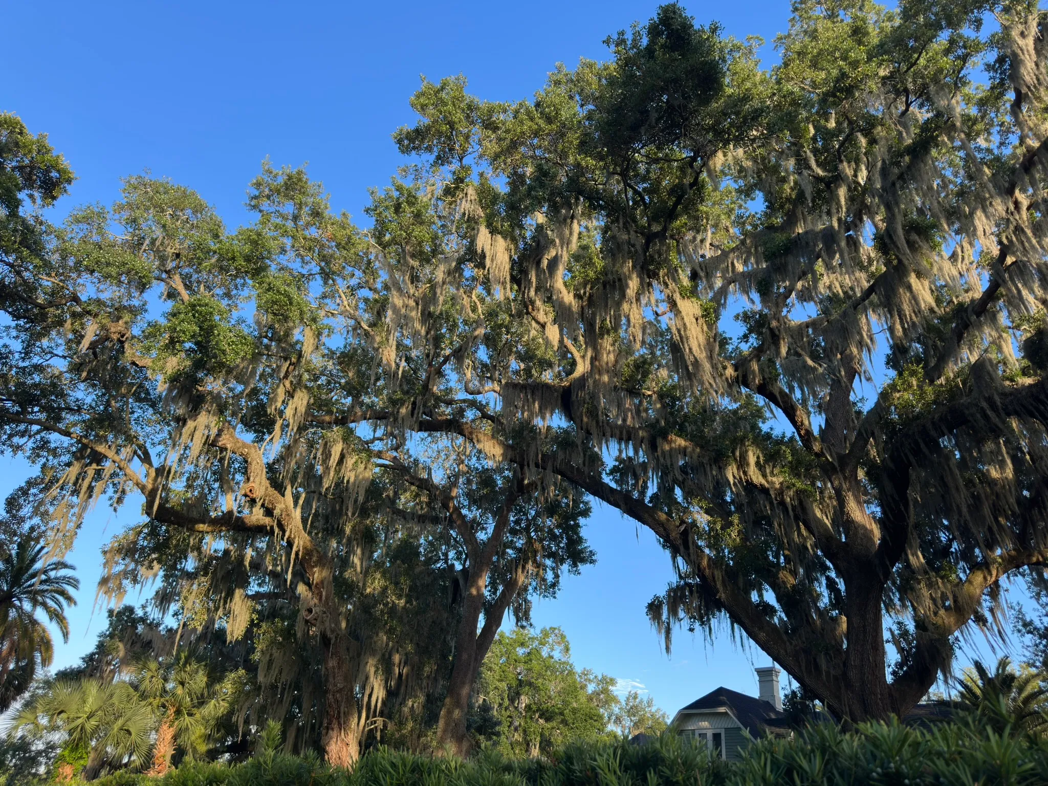
After the water, the next thing the eye registers is the live-oak canopy. The trees are Southern live oaks, Quercus virginiana, native to the coastal-plain South. Per UF/IFAS they grow to sixty or eighty feet tall, spread out sixty to a hundred and twenty feet across, and live for hundreds of years. Some of the mature oaks at the lake’s edge plausibly predate the 1981 historic-district designation, and given their size, the 1887 Honeymoon Row homes. No one’s done a formal tree-age estimate for any particular oak.
The oaks do real ecological work. Their crowns hold epiphytes (Spanish moss, resurrection fern, lichens, sometimes orchids), none of which are parasitic and all of which add layers of habitat. The deeply furrowed bark on older trees shelters insects and small reptiles that feed birds: woodpeckers, warblers, wrens, vireos. The wide low crown is one of the most wind-resistant tree shapes Florida has.
Spanish moss, Tillandsia usneoides, is not a moss and not a parasite. It’s an epiphyte in the bromeliad family, the same family as the pineapple. It draws its water and nutrients from air, rainwater, and the debris that catches in its scales. Per UF/IFAS, heavy moss on a tree is what happens when the canopy thins and more sunlight reaches the trunk; the moss is responding to the decline, not causing it.
The historic-district designation protects the streetscape. Whether it covers individual trees is a separate question; tree protection in Orlando typically lives in the city’s tree ordinance, separate from the Historic Preservation Board’s scope.
Wildlife
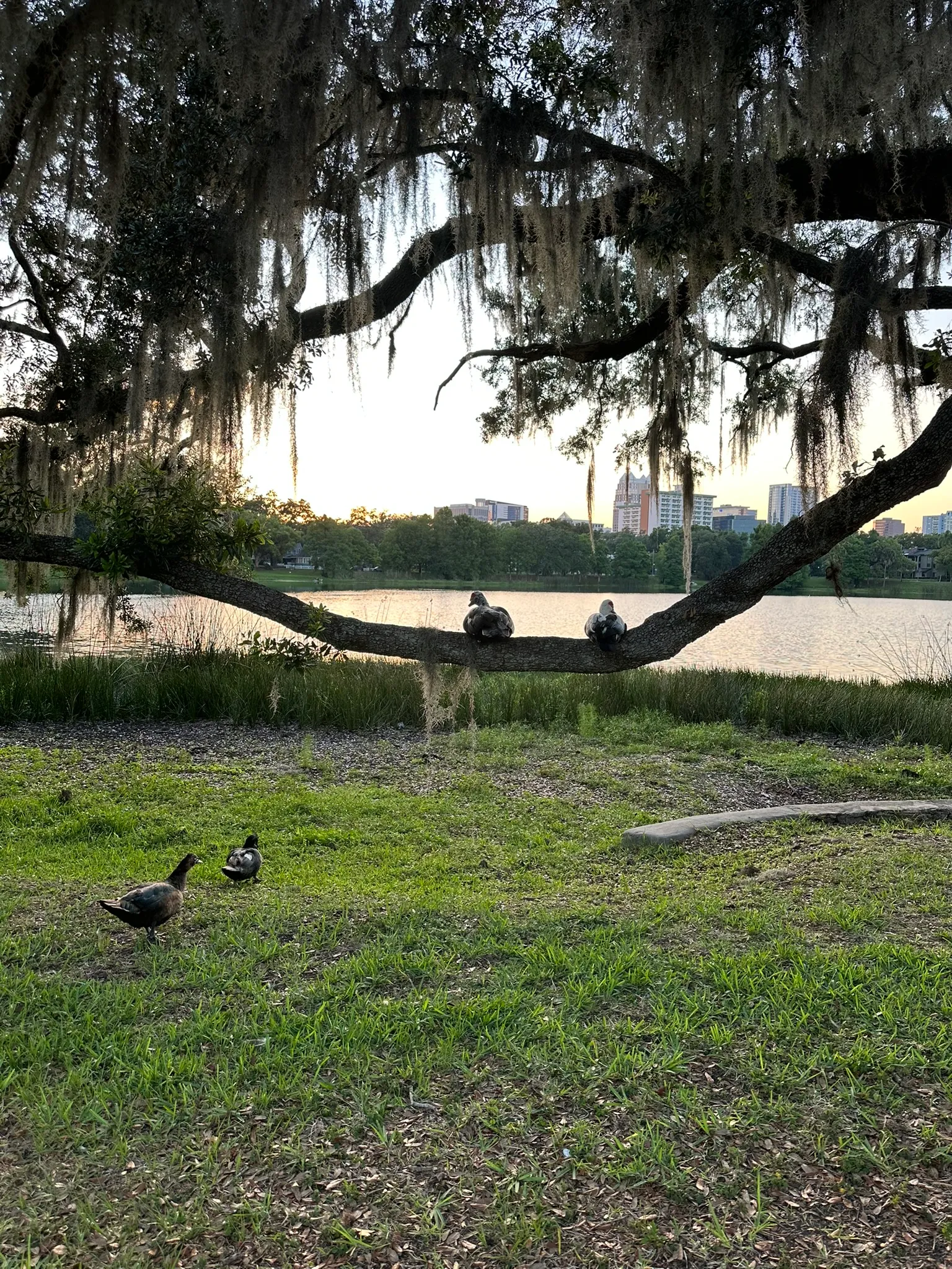
There is no public species inventory specific to Lake Cherokee. The City has forty years of water-quality data and no comparable biological survey of the lake itself. The LCNA’s restoration proposal calls for a fish-community electrofishing survey in Phase 2 because that baseline doesn’t yet exist.
Birds first. Wading birds and waterfowl are the most visible: herons, egrets, and the ducks. The nearest peer with a real bird record is Lake Eola, an eBird hotspot just a few blocks north. Per Orange Audubon, the species you’d see there year-round are native Florida herons and egrets; winter brings Lesser Scaup, Hooded Mergansers, White Pelicans, terns, and Peregrine Falcons, with occasional Roseate Spoonbills. Lake Cherokee is smaller and quieter, which probably shifts the mix toward more reclusive native waders and away from the people-acclimated species.
The Great Egret carries a piece of conservation history. The species was nearly hunted to extinction in the late 1800s for its breeding plumes, which had become a fashion item; the National Audubon Society was founded in part to protect them, and the Great Egret is the organization’s symbol to this day. When one stalks the Lake Cherokee shoreline, that’s what’s standing there.
Turtles next. The freshwater species you’re likely to see at any small Central Florida lake, per FWC, are the Florida Red-bellied Cooter, the Peninsula Cooter, the Yellow-bellied Slider, and the Florida Softshell. There’s an active conservation note worth knowing: FWC Executive Order 21-19 prohibits taking or transporting softshell turtles and yellow-bellied sliders because of a fraservirus outbreak. If you see a sick or dead turtle at the lake, report it to FWC instead of moving it.
Fish, last. The LCNA proposal records largemouth bass and bluegill among the dead in the 2025 fish kill. Both are typical Florida warmwater-lake fish; their presence is what the lake should support in a good year. The stress in 2025 was dissolved oxygen, which got as low as 0.18 mg/L in spot measurements. That’s near anoxic. The fish community wasn’t the problem; it was suffocating.
The brick streets
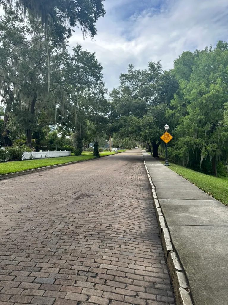
Cherokee Circle, the loop around the lake’s eastern shore, is paved with vitrified clay brick. Other district streets are brick too. Nobody’s dated the paving precisely, but it fits the Florida brick-paving era: most Florida residential brick paving went down between the 1900s and the mid-1920s, with Orange County’s peak around 1915 to 1916.
The brick is structural, not decorative. It’s the actual pavement, laid in a sand bed by the standard Florida technique of the era. The bricks were fitted closely enough that, as a Tampa Bay Times piece on St. Petersburg’s preservation work put it, “a piece of paper wouldn’t fit between them.” They were also vitrified, fired hot enough that the clay and sand fuse and the moisture-absorption rate drops to almost nothing. That fusion, the close fit, and the sand bed are what let these streets carry a century of Florida humidity and the modern vehicle loads they were never designed for.
These streets survive because a decision was made not to pave over them. Lake Cherokee was inside Orlando city limits when the city’s historic-preservation framework took shape in 1976, and the district was designated in 1981. Street-level changes today fall under Historic Preservation Board (HPB) review. The same narrowness that makes these streets a traffic concern for the Cherokee School proposal is what kept them from being widened and asphalted in the middle of the twentieth century.
There’s a practical reason the streets matter to the lake, not just the streetscape: they’re impervious cover draining toward it. Any future stormwater retrofit will have to handle them as both a hydrologic input and a preservation constraint. A curb-cut bioswale isn’t only a drainage decision; it’s an HPB question.
Stewardship
Lake Cherokee gets its day-to-day stewardship from the people who live around it. That’s been true so far, and it’ll keep being true after the first elected board takes office on June 15, 2026.
The March 2026 restoration proposal submitted to the City exists because residents did the groundwork: coordinated shoreline and watershed trash removal, community sampling to supplement the City’s monitoring record, drone documentation of lake-surface conditions, and the writing of the proposal itself in consultation with a professional environmental engineer. The proposal commits the Association, once formally organized, to function as a community co-applicant with the City through the four-phase restoration program.
Beyond what the Association does, there’s a list of things any neighbor can do. Appendix A of the proposal is a checklist written for distribution to anyone in the Lake Cherokee watershed:
- During visible bloom conditions (blue-green, olive, or pea-soup-green water; surface scums; musty odor; dead fish at the shoreline; foam): no swimming, wading, kayaking, or pet contact. Don’t eat fish caught during or just after a bloom. Report blooms to FDEP at (407) 894-7555 or #DEP from a mobile phone; report suspected illness to FDOH at (407) 858-1400.
- Lawn and landscape: use phosphorus-free fertilizers, the kind with a zero as the middle number (15-0-15, for example). Comply with Orange County’s fertilizer ordinance, which prohibits nitrogen and phosphorus applications from June 1 through September 30. Keep clippings and leaves out of streets and storm drains. Where possible, establish a ten- to fifteen-foot native plant buffer at the shoreline in place of turf grass.
- Wildlife and waterfowl: don’t feed waterfowl. Always collect pet waste. Report nuisance alligators to FWC at (888) 404-3922.
- Stormwater: keep the curb in front of your property clear of debris before rain events. Wash cars at a commercial car wash or on an unpaved lawn area, never on driveways. Report suspicious storm-drain discharges (chemical, sewage, or colored water) to the City of Orlando at (407) 246-2314 or #DEP.
These aren’t waiting on the future board. Any resident can do them now.
The established statewide channel for volunteer water-quality monitoring is Florida LAKEWATCH. It’s a UF/IFAS citizen-science program, running since 1986, with 883 active volunteers monitoring 627 waterbodies. Volunteers collect monthly samples (water clarity, chlorophyll, nutrients) and drop them at a local UF/IFAS Extension office; the LAKEWATCH lab in Gainesville does the analysis. Training and supplies come with the program. Enrolling Lake Cherokee, or confirming the enrollment that may already exist informally, is one of the first things on the new board’s list.
The full assessment, the restoration phasing, and the original Appendix A all live on the Lake Restoration page.